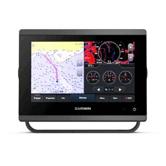


Descrizione
Cartografia Local MAX-N+ Discoversu supporto SD-Micro SD SOLO per B&G, Simrad, Lowrance
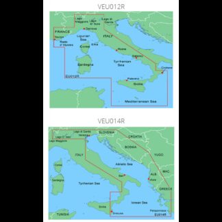
Mar Tirreno- Med. centrale discover DISCOVER LOCAL – TIRRENIAN SEA-CENTRAL MEDITERRANEAN
Cartography for Lowrance, B&G, Simrad. Verify that the instrument software is the latest version available. 32GB SD / MSD SUPPORTVector charts, including depths, contours, sounding points, NavAids, light sectors, wrecks/obstructions and more. Visualize the highest level of information, setting clear safety depthsand identifying underwater pinnacles, ledges and canyons, coastal game magnets. High-resolution details of nearshore and offshore features such as pinnacles, canyons and ledges that help anglers, including Genesis Data. EASY ROUTING WITHOUTView time, water level and tide direction with tide level charts.of tides with tide level charts and indicates current time, direction and predicted strength. Flow charts and colored arrows.RASTER GRAPHS Raster charts give a traditional graphical look and feel to the chart.traditional look to the chart. SHADED RELIEF Shaded Relief presents data with a 3D appearance, which is easier to interpret thantraditional contour lines. SATELLITE OVERLAY Satellite imagery provides real-world references, enhancingsituational awareness for coastal navigation
Cartografia